
Koh-i-Takatu is a mountain located in the north of Quetta District of Balochistan Province, Pakistan. It is part of the Sulaiman Mountains range. It has two peaks..


It is also called Takatu mount or simply Takatu Mountain.

Koh-i-Takatu has an elevation of 3,472 metres (11,391 ft) It is the second highest peak of Quetta District and third highest peak of Balochistan province.


Koh-i-Takatu is stretched on a huge plain. It covers an area of approximately 60 squares per km. It starts from inside Quetta city and ends at the border of Ziarat district.


Koh -e- Takatu has terrain which is scattered across the rugged rocky, somewhere steep, sparsely wooded mountainous area. It has also fertile lands.


There are difficult narrow gorges and many fresh water springs.
 |
| Near Quetta_Ziarat road via Sraghurgai-Kach near Thakatu base. |

It provides good browsing for sheep, goats, and camels and is source of feed for livestock.


Koh-e Takatu terrain has huge variety of alpine flowers with beautiful shapes, designs and colors. The mountain also has large variety of herbal plants, shrubs and tress including juniper trees.


 |
| Shin Gul is a medicinal plant |


These plants conditions are unbelievably harsh and imposegreat challenges to survival in the face of very high winds, extreme cold, wildly fluctuating temperatures, rocky soils, snow and ice.


Koh-e- Takatu is also an excellent habitat to wild animals. There is variety of wildlife. The most distinctive is Markhor, which is the national animal of Pakistan.

The terrain above the tree line, vegetation is dwarfed by harsh climate and short growing season. It becomes entirely rocky near the summit of peak.
 |
| Rocky terrain near Takatu top |

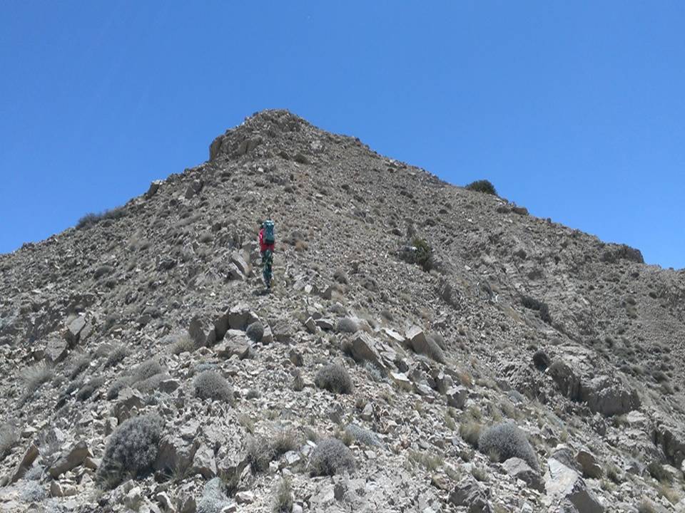
There are many trekking trails to climb the mountain from different areas. One of the routes is from Bostan DarraThe tracks are extremely remote and challenging walk
 |
| Bostan Darra, from where the trek started |
 |
| Water reservoir at the Gorge |
The trek is approximately 30 km from base to top of summit. The trek is very long with steep and strenuously track.

 |
| Last stage of the long trek |
From the top of summit far distance valleys covered with clouds are be seen which gives mesmerizing view. From one side Khalifat Peak, Chapper Rift and Harnai Valley are seen and from north side Quetta Valley, Chiltan Char Shakh, Spin Karez; almost everything around can be seen.

 |
| Northern Peak of Takatu: Harnai Valley and Ziarat Heights in distant background |
 |
| South view: Chiltan and Quetta |
 |
| View of Sra Khula Valley |
 |
| Chapper Rift seen above on left |
Koh-i-Takatu is contain unique and hidden beauty inside its vast area.. It is full of beauty which is explored only by trekking. There are plenty of amazing hiking routes


It provides best picnic spot with natural pristine environment. People visits its base and enjoy adventurous life. They do camping, trekking and some go for countering to enjoy panorama views.

****************************************************************************